- 2025-2026 UNH Senior Project GroupAcoustic Sensor for Measuring Slick Thickness During Oil Spill ResponsePresented their project at the UNH Fall event and to the Project Advisory Committee
- Spills Advisory Group (SAG)
CRRC Research and Activities Updates
Nancy E. Kinner, Center Director
October 8, 2025 - James Wood, University of New Hampshire master student with CRRC and ADAC Fellow participated in NOAA's Science of Oil Spills in Anchorage, AK.
He joined USCG, OSROs and NOAA colleagues in this course and during his Internship in Alaska (September 2025).
His class photo showed up the in the Alaska Chadux Network Newsletter. - Madeline Dubosque, University of New Hampshire undergraduate and ADAC-Arctic Fellow participated in the ASIP program in Alaska during the summer of 2025. See the ADAC-Arctic Newsletter here
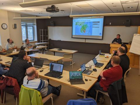
- Boston Area Committee MeetingRemote Sensing of Oil SpillsNancy E. Kinner, Center Director
June 25, 2025
OSPR's 11th Biennial Oil Spill Response Technology Workshop. On behalf of CRRC & NOAA, Nancy Kinner presented on 2 pertinent topics on May 30, 2025.
- Remote Sensing for Spill Response: Operational and Research Needs and Strategies for Transitioning New Technologies to Operations (authors: Nancy Kinner, Lisa DiPinto)
Abstract: NOAA’s Office of Response and Restoration (OR&R) partnered with the Coastal Response Research Center (CRRC) to
facilitate a 2-day hybrid workshop titled “NOAA OR&R Remote Sensing/UAS Workshop” identified overarching concepts,
knowledge gaps, challenges, and research regarding the current capabilities of oil spill remote sensing of NOAA and its
partners, including government and state agencies, and the private sector (e.g., OSROs, contractors). The resulting
conversations explored state of the art technologies that could be deployed during a spill event and complications introduced to
response and recovery efforts by data delivery timelines, data products, and remote sensing technology (RST) availability and
capabilities. Topics covered included operational needs for OR&R for remote sensing, advancements on remote sensing within
federal and state agencies, and advancements on remote sensing within the private sector. Participants have identified
examples of successful use of remote sensing technologies and explored partnership opportunities to transition them into
operations. Conclusions and recommendations included: Operationalization: Transitioning state-of-the-art technologies from
development phases to the field has proven challenging for all partners. Adaptation to quickly evolving scenarios and regulations
is essential to derive meaningful data products for decision-makers. Data Flow and Management: As remote sensing
technologies (RSTs) develop, the size of their data products increase and impede the speed at which they are delivered to
incident command centers (ICCs). New satellite networks (e.g., Starlink) are transforming and simplifying data delivery
workflows. Standardization of these complex data products could be helpful to ensure comprehensive and common
understanding of information among responders and decision-makers. Synoptic Sampling: A comprehensive remotely sensed
image collection is desired for every response scenario. A matrix of assets/use cases and rapid deployment at all levels (i.e.,
satellite, fixed-wing, UAS) is essential to achieve this. Emerging Platforms: Forthcoming satellites (e.g., GLIMR) present exciting
new advancements in the remote sensing community. Integrating these systems into response will be beneficial. Research and
Development: Prototype RSTs require validation testing in controlled and field environments to prove their worth. Locations such
as the CRRC indoor high bay and Facility for Outdoor Remote Testing (FORT), Oil and Hazardous Materials Simulation
Environmental Test Tank (OHMSETT), CRREL, and the Experimental Lakes in Canada present opportunities for establishing
baselines and sensor capabilities. Partnerships and Coordination: Networking among entities involved in response prior to
events occurring is paramount for successful incident mitigation. Partnerships and connections will ensure preparedness, response, assessment, and restoration phases are as organized and efficient as possible.
2) Use of Commercial Off the Shelf Acoustic Sensor for Detecting Oil on the Water's Surface and Under Ice (authors: Sara Berg, Gabe Venegas, Nancy Kinner, Scott Pegau, Lisa DiPinto).
Abstract: The Coastal Response Research Center (CRRC) and NOAA’s Office of Response and Restoration(OR&R), using funding provided by the U.S, Coast Guard's Great Lakes Center of Expertise for Oil Spills (GLCOE)and the Oil Spill Recovery Institute (OSRI), are evaluating the capabilities of an AQUAScat 1000 commercial off the shelf acoustic sensor to detect marine diesel, MC20, and a Line 5 pipeline oil: floating on water with and without waves, and located in a cavity under freshwater ice. The AQUAScat has four sensors: 0.5, 1, 2, and 4 MHz. In testing at the CRRC’s highbay validation facility, the AQUAScat began sensing the floating oil slicks when they reached 2.5 mm in thickness. Floating slicks up to 20 mm were detected. The sensors were able to resolve differences on the order of 1.25 mm. Testing with the AQUAScat is currently ongoing in a tank containing 1 ft thick freshwater ice. A 6-8 in. diameter cavity in the ice is filled with increasing amounts of marine diesel or MC20 crude. The Aquascat is able to discern the thickness of the oil in the cavity with both fuels by detecting the ice at the top of the cavity and the oil's surface. However, this can only occur for relatively small amounts of oil. Once that threshold is exceeded, the oil can be detected vis-a-vis the under ice
surface, but thickness cannot be determined as the ice at the top of the cavity is not detectable. Results from the ice tank and validation facility testing will be reported along with a discussion of the suitability of the AQUAScat for use in spill response.
- Spills Advisory Group (SAG)
May 2025
CRRC co-director offered updates on numerous projects by CRRC and NOAA - IARPC presentation onNome Visualization Tools for Improved Decision-Making During Disasters Workshop Readout: Joint Terrestrial Ecosystems & Risksby Nancy Kinner, CRRC - - April 17, 2025
Recording available on the event page as well as the IARPC YouTube channel - ME/NH Area Committee Meeting
November 7, 2024
Nancy Kinner presented, Deploying Drones for Spill Response - Spills Advisory Group - science meeting
CRRC activities update
Nancy Kinner, Coastal Response Research Center
October 16, 2024 - OAA ORR Science Friday Webinar - CRRC's Remote Sensing Research Activities OverviewSeptember 20, 2024
- KNOM Radio - Story on CAPRI with Nancy Kinner and Ukallaysaaq Okleasik (May 23, 2024) Listen here>>
CRRC's presentations and papers at IOSC 2024:
- Critical shear stress of sunken, No. 6 heavy fuel oil in fresh water, Gloekler, Kinner, et al (Marine Pollution Bulletin 203 (2024) 116430
- Flume studies of movement of crude and diesel oil under ice, Wood, Kinner et al (IOSC2024)
- Transport of Sunken Very Low Sulfur and No.6 Heavy Fuel Oils on Sand Substrates, Sweet, Kinner, Gloekler et al (IOSC2024)
- The Evaluation of Remote Sensing Methods to Determine Oil Slick Thickness, Lambert (IOSC2024)
- Effect of Water and Air Temperature and Light Levels on Thermal Sensing of Oil Slick Thickness, Lambert, Garcia, Pegau, et al (IOSC2024)
- Oil Slick Thickness Measurements using Thermal Sensors in Arctic Conditions, Lambert, Garcia, DiPinto et al (IOSC2024)
Join the Coastal Response Research Center at 2024 International Oil Spill Conference in New Orleans, LA
Please visit us at Booth #330; May 13-16, 2024
- Monday 5/13 at 6:30 pm CT – Oil Spill Modeling Working Group Kick Off Meeting NOTES
- Tuesday 5/14 at 12:30 pm CT – Remote Sensing Working Group Kick Off Meeting NOTES
- Tuesday 5/14 at 5:30 pm CT – CRRC 20 Year Celebration
- Wednesday 5/15 at 12:30 pm CT – Shoreline Response Working Group Meeting NOTES
- Wednesday 5/15 at 6:00 pm CT – Dispersant Working Group Meeting NOTES
- Wednesday 5/15 at 7:00 pm CT – Submerged/Sunken Oil Working Group Meeting
- Thursday 5/16 at 11:30 am CT – Toxicity Working Group Meeting
Spills Advisory Group - science meeting
CRRC activities update
Nancy Kinner, Coastal Response Research Center
April 17, 2024
- Operationalizing the Use of Uncrewed Systems for Environmental Response NOAA ORR, USCG GLCOE, WaterMapping LLC (released January 2024)
- Nurdles Overview to Georgetown (ME) Presentations
Nancy Kinner, Coastal Response Research Center
Lisa DiPinto, NOAA Office of Response & Restoration
February 15, 2024 - Operationalizing the Use of Uncrewed Systems for Environmental Response, NOAA ORR, USCG GLCOE, WaterMapping LLC (released January 2024)
- Nancy Kinner participated in and was interviewed:
Louisiana Oil Leak: Potential Impact to Animals, Coast
Newsweek, 11/22/2023 - UNH Profile of Service was awarded to Nancy Kinner October 12, 2023
- Maine/New Hampshire Area Committee Meeting
Wesley Lambert & Nancy Kinner presented on the remote sensing oil spill response research
October 11, 2023 - Summer Internship Program in conjunction with University of Puerto Rico, Mayaguez
7-week program held May 21 - July 8, 2024
Project Oral Presentations:
Francisco - Slipper Limpet population increase & its affect on local predators
Marissabel - Integrating Image-Based Phytoplankton Taxa
Hakeem - Canopy Arrangements for Waste Collection in Deep Sea & Shallow Water
Giovani - Coastal Habitat Restoration
Biajani - Sunken Oil Flume Experiments
Lizmar Luna - The Effects of Biofueling on Sinking Microplastics
Emily - Validation of Remote Sensing - CRRC/ORR Renewable and Emerging Fuels Workshops Overviewby Nancy Kinner
Reg 1, Regional Response Team, June 28, 2023 - CRRC Students present at the ORR Science Webinar: Oil Slick Thickness and Oil Movement Under Iceby Wesley Lambert and James Wood, June 16, 2023
- CRRC Activities Overview to Spills Advisory GroupApril 25, 2023
ERMA Developer's Summit
ERMA Developer's Summit @ UNH, April 25-27 2023
- Comparing Recent Advances in Estimating and Measuring Oil Slick Thicknessby Nancy Kinner (Lambert, DiPinto)
10th Biennial OSPR/Chevron Oil Spill Response Technology Workshop, March 29, 2023 - Comparing Recent Advances in Estimating and Measuring Oil Slick Thicknessby Nancy Kinner (Lambert, DiPinto)
10th Biennial OSPR/Chevron Oil Spill Response Technology Workshop, March 29, 2023 Prediction of Movement of Spilled Oil under Ice by James Wood
First place in 2023 Civil and Environmental Engineering Research Conference
- CRRC presentation on Oil Movement Under Ice research ME/NH Area Committee meeting, April 4, 2023
- Oil On Ice, Preparing for Spills in a Changing Arctic: NOAA Scientists Develop Technologies for Oil in Ice ExperimentsNOAA Office of Response and Restoration, 3/28/2023
- Oil Spill Response: 25 Years After the Exxon Valdez and in the Wake of Deepwater Horizon, What Have We Learned and What Are We Missing?October 28 & 29, 2014
- Outreach Event for the CRRC/GLCOE/NOAA/LSSU oil in ice remote sensing experiment (video)
Experiment conducted March 6 - 16, 2023 - Review of ICCOPR's 2022-2027 Oil Pollution Research and Technology PlanNational Academies of Sciences, Engineering, and Medicine 2023
- NRT Co-Chairs Meeting in Portland, ORFebruary 16, 2023 by Dr. Nancy E. Kinner
- Sunken Oil Transport Tool (SOTT) available from UNH Innovation Shop2022/2023 by Dr. Melissa Gloekler, University of New Hampshire
- CRRC Presentation at the Spills Advisory Group meetingOctober 19, 2022 by Center co-director Nancy Kinner
- Presentation on the Oil Spill Modeling for Improved Response to Arctic Maritime Spills Dr. Nancy Kinner and Tori Sweet gave on behalf of the Arctic Domain Awareness.
April 20, 2022 - Overview of the Center's activitiesOn behalf of CRRC and CSE, Nancy Kinner offered an overview to the Spills Advisory Group (SAG) on
April 13, 2022 - 2021 Annual ReportThe Pacific States/British Columbia Oil Spill Task Force is pleased to present highlights of our current work, and a glimpse of our member agencies.
- UNH co-director's presentationThe Center participated in the ME/NH Area Committee meeting.
October 21, 2021 - The Spills Advisory Group (SAG) were debriefed by Dr. Nancy E. Kinner on the Center projects October 13, 2021
- Digital Journal's article "Questions surround the timeline in response and notification on the California oil spill" quoted UNH co-director Nancy Kinner
- Pressform quoted UNH co-director Nancy Kinner "Marshes, Shorebirds Could Face Biggest Threats From California Oil Spill" article
- Yahoo News interviewed UNH co-director, Nancy Kinner regarding the California spill
- AccuWeather Network interviewed UNH co-director, Nancy Kinner regarding the California spill
- Popular Science interviewed UNH co-director, Nancy Kinner regarding the California spill
- Los Angeles Times interviewed UNH co-director, Dr. Nancy Kinnerregarding the Huntington Beach, CA oil spill
- Newsweek interviewed UNH co-director, Nancy Kinner regarding the Huntington Beach, CA oil spill