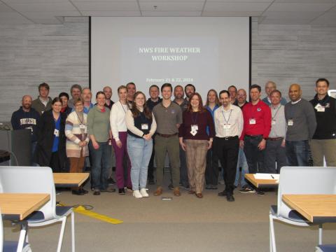
This in-person workshop is sponsored by NOAA’s National Weather Service and hosted by the University of New Hampshire’s Coastal Response Research Center.
Dates: February 21 & 22, 2024 (Wednesday & Thursday) from 8:30 - 4:30 MT each day
Workshop Objectives
- Identify NOAA fire weather -related GIS requirements for planning and operational fire environment applications for possible inclusion in the NWS National GIS Viewer and OGC compliant services.
- Assess the NWS National GIS Viewer’s capability to assist in the monitoring of ongoing spot weather forecasts.
- Identify fire-related GIS resources for potential inclusion in the NWS National GIS viewer (e.g. planning and operational fire environment applications).
Location
National Interagency Fire Center
Great Basin Training Room
3833 S. Development Ave
Boise, ID 83705
Agenda
Agenda here>>
Participants

Revised post-workshop participant list here>>
Presentations
Welcome, Nancy E. Kinner, UNH Director, Coastal Response Research Center (CRRC)
Recognition of Developers
History & Project Goals, Kari Sheets, NOAA/NWS
Session Recording here>> (mp4 file)
Overview and Objectives of the Workshop, Robyn Heffernan/Julie Malingowski, NOAA/NWS
Demonstration of Fire Site, Jonathan Wolfe/ Chris Ridener, NOAA/NWS
Session Recording here>>
Discussion and Demonstration of Fire GIS Requirements & Resources
Brian Miretzky/Robyn Heffernan/Julie Malingowski
Cole Belongie/Sean Triplett
Matt Jolly, Requirements for fire modeling inputs
Dan Nietfeld, GFE Forecast Monitor/Spot Monitor Project
Session Recording here>>
Resources
The NWS GIS Viewer Fire Site one pager
Steering Committee
Nancy Kinner, CRRC/UNH
Benjamin Bartos, NWS
Robyn Heffernan, NWS
Heath Hockenberry, NWS
Julie Malingowski, NWS
Brian Miretzky, NWS
Emily Niebuhr, NWS
Nipa Parikh, NWS
Kari Sheets, NWS
Scott Stearns, NWS
Ryan Walbrun, NWS
Questions? Please contact Kathy Mandsager